Sugar Hill Greenway.
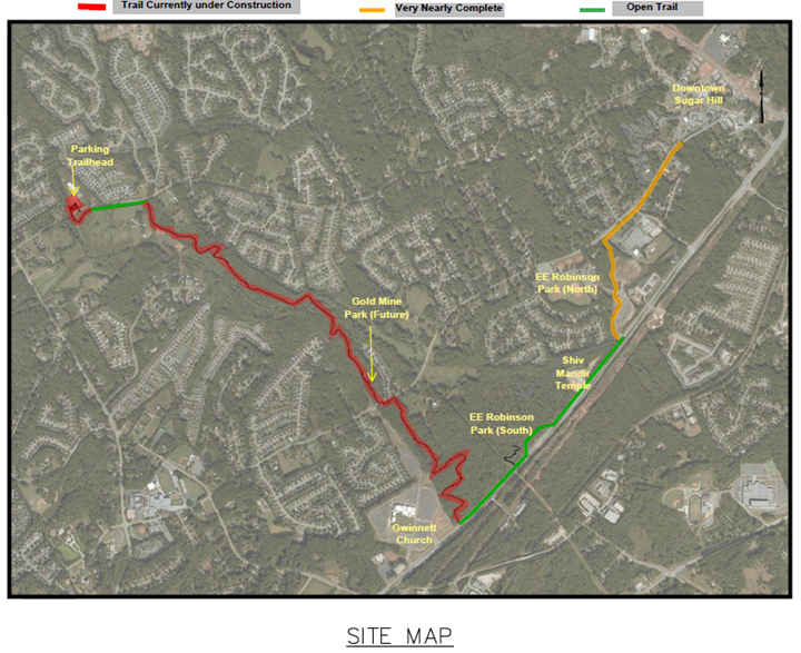
Sugar Hill Greenway Map
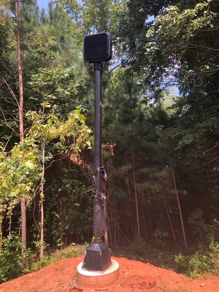
TriScapes Construction (TSI) is currently focusing attention on the 3rd segments of their contract that take the proposed trail from Level Creek Road westward to Whitehead Road. More specifically, they are working on installation of a series of boardwalk segments in the environmentally sensitive areas. These segments follow the old Georgia DOT right-of-way for the outer perimeter project and follow many of the most scenic places in the city. Bridge and boardwalk construction has begun in these areas as well, which will be some of the longer divisions of work to be completed. A pedestrian crossing signal has been installed on Level Creek Road near the back entrance to Gwinnett Church where the trail will cross (just south/west of Markim Forest subdivision). The signal, at the entrance to the city’s newest park (Goldmine Park-440 Level Creek Road) will be activated once the trail is closer to completion and the county approves the installation.
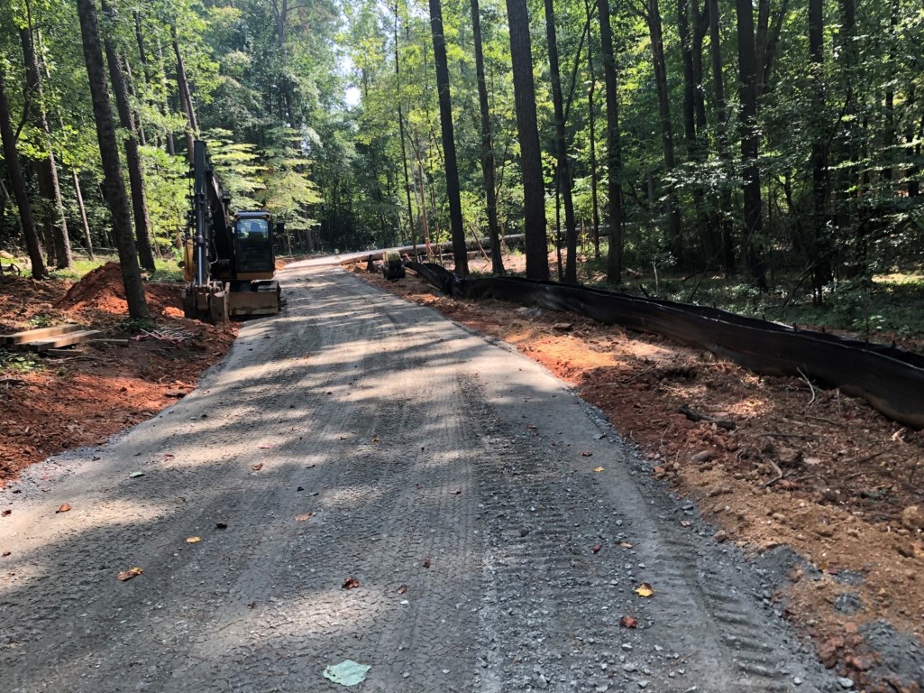
Trail segment approaching boardwalk in the background behind excavator.
While the segment on Level Creek Road and through EE Robinson Park (North) has been paved, some sections are still blocked off and within the contractor’s work zone. The public is encouraged to stay off the trails in these areas until the barriers are removed and it is safe to use. The trailhead at Bethany UMC on Whitehead has been constructed and is awaiting progress on the trail segments closer to the area prior to final completion.
The Sugar Hill greenway trail is a transformative investment in greenspace, alternative transportation and recreation opportunity. The benefits of the trail have been described in terms of economics by way of improved property values, health effects by way of improved activity levels, environmental protections by highlighting the natural environment encircling the city, and traffic demand reductions by decreasing reliance on automobile trips (to recreation, restaurant and shopping destinations). Reference Sugar Hill’s greenway trail master plan website for more information about this and future phases. www.sugarhillgreenway.com
Project Highlights
- The trail was envisioned in 2014, with the first trail segment completed in 2018 along Peachtree Industrial Boulevard.
- The greenway is comprised of 11.5- linear miles of greenspace and will be connected by nearly 16 miles of walking and biking trail sewing together key destinations/nodes in the city.
- The trail will be 10 to 12 feet in width and be paved with concrete along roadways and asphalt in natural areas.
- The first phase connects downtown with (3) three parks and (2) trail head parking lots clockwise from downtown to Gwinnett Church and westward to Whitehead Road.
- The trail is expected to cost about $17 – $20 million by the time future phases are constructed.
- Most of the first phase is constructed with SPLOST (voluntary sales tax dollars) funds.
- Phase 1 (5 miles) anticipated completion date – 2021.
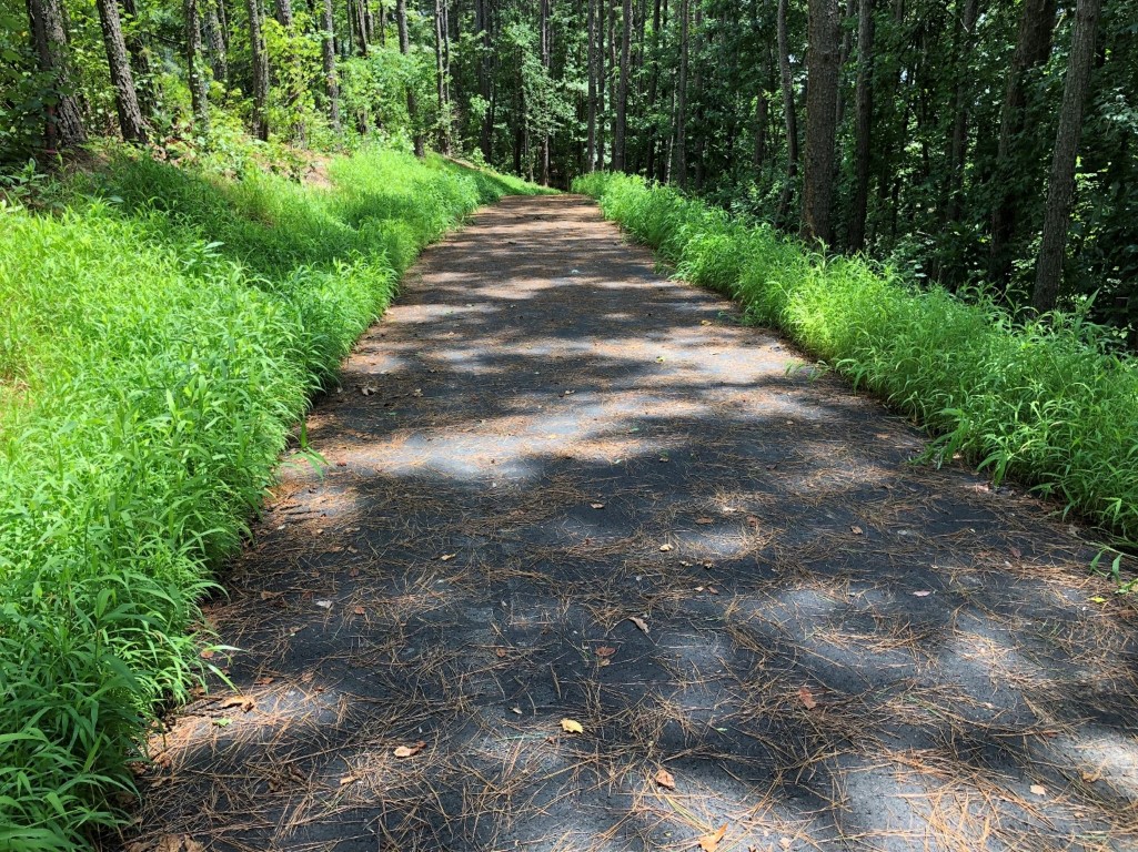
Greenway Trail Segment – Asphalt trail segment through EE Robinson Park (North).
The TSI contract will encompass about 4 and a half miles of trail construction, beginning at the intersection of Level Creek Road and Church Street and extending both along roadways and through natural areas to Whitehead Road, temporarily ending at a trailhead parking lot at the Bethany UMC Church located at 144 Whitehead Road near the new bridge.
Gold Mine Park. Construction is underway and clearing operations have begun. TriScapes (TSI) was the low bidder and was awarded this contract. The park serves as a trailhead on the city’s greenway and offers a chance for guests to learn more about the city’s gold mining history. The park will have some 50 parking spaces, a restroom, bicycle racks, and information about the cultural and historical significance.
22 Acre Park – Highway 20. Architectural design work is has been completed for the restroom and pavilion building to establish a style consistent with historic uses on the property. The following images capture the styles being considered.

After a lengthy evaluation of the pond and dam, these items will need to be completely reconstructed as a part of the project, but will most likely be broken out into two separate contracts. The project will still involve the construction of a small parking area, walking trails, pavilion, restrooms, and maintenance equipment storage.
LMIG – Roadway Repairs & Resurfacing. This contract has been let and notice to proceed issued for this year’s edition of the road repairs program. Allied Paving is the city’s contractor for this set of streets and will begin work the week of April 19. The following roads are awaiting completion of a water main replacement project in the Frontier Forest neighborhood:
Frontier Drive
Forest Green Way
White Oak Drive
Frontier Way
Frontier Trail
Davis Street
Downtown Regional Stormwater Pond. A flood control and improvement project is set to get started in early 2022 which will provide additional storage for runoff volume in the pond behind city hall. The project is funded through the ARP program and will reduce the flooding frequency in the area and provide the pond’s water quality treatment function.
