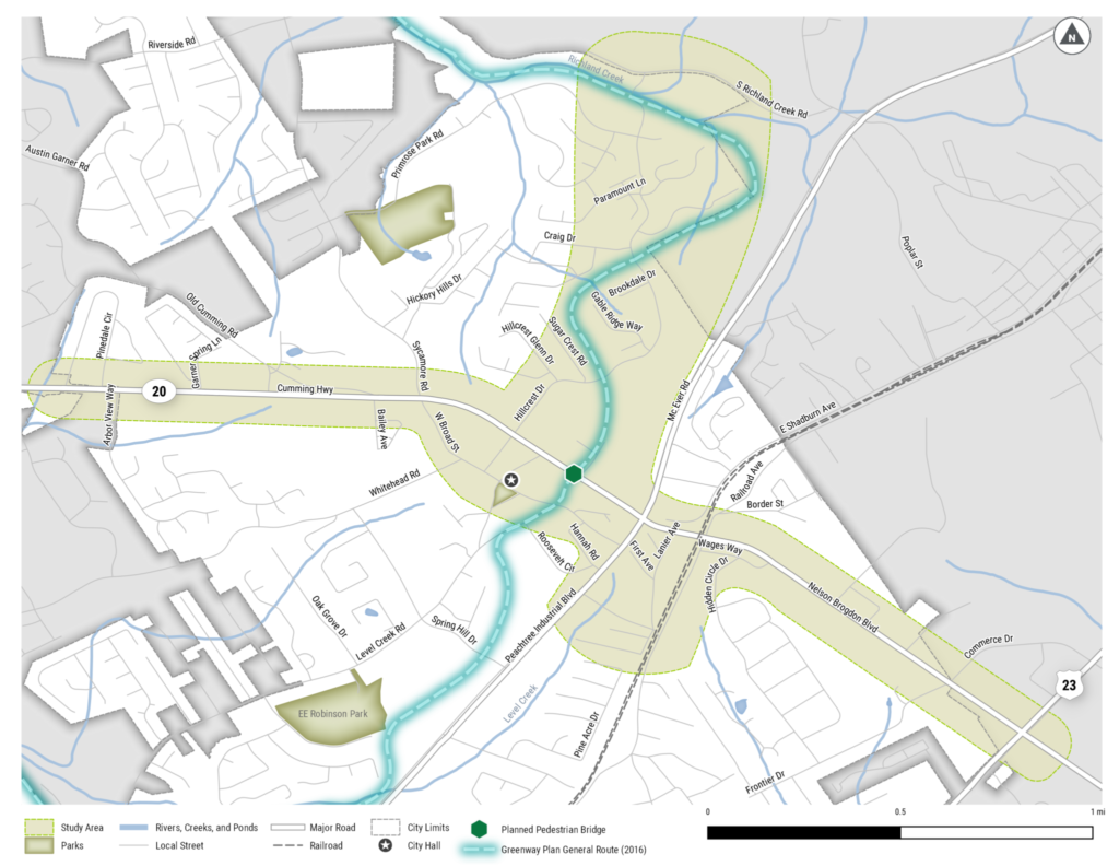
|

The Sugar Hill Greenway Concept Livable Centers Initiative (LCI) builds on ongoing efforts to make Sugar Hill an inviting place to walk, bike, and connect with nature. Previous plans and projects that have led to this effort include: the Sugar Hill Greenway Master Plan (2016), the Sugar Hill SR 20 Corridor Study (2018), the Sugar Hill Downtown Master Plan LCI (2018), and the Gwinnett County Trails Master Plan (2018). This effort supports the Sugar Hill concept by adding an east-west connection along the State Route 20 (SR 20) corridor (Pinedale Circle to Buford Highway) to improve access from neighborhoods to Downtown, local businesses, and parks. It also includes the north-south connection between Downtown and Richland Creek that will form part of the Sugar Hill Greenway. An exact route for the greenway within the study area has not yet been selected and will be determined as part of this planning process.

Guiding Principles:

  1. Designing a safe and comfortable facility for users of all ages and abilities.
  2. Connecting community facilities and other useful destinations.
  3. Maximizing access to nature.
  4. Using existing public land and right-of-way as much as possible.

Project Scope:

  • Analyze existing conditions.
  • Engage with the community.
  • Select a preferred alignment.
  • Develop a conceptual design.
  • Prepare a draft GDOT Concept Report.

The planning and conceptual design will take place during summer 2020, with a draft report targeted for the end of August. The project is funded with support from the Atlanta Regional Commission’s LCI program, a grant program that incentivizes local jurisdictions to re-envision their communities as vibrant, walkable places that offer increased mobility options, encourage healthy lifestyles, and provide improved access to jobs and services.

Project Materials

Close Search Window
Skip to content